


Holiday Voting District, Snohomish County, Washington
About
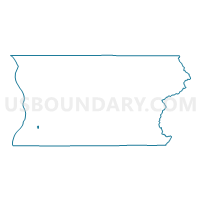
Outline

Summary
| Unique Area Identifier | 688599 |
| Name | Holiday Voting District |
| County | Snohomish County |
| State | Washington |
| Area (square miles) | 0.25 |
| Land Area (square miles) | 0.25 |
| Water Area (square miles) | 0.00 |
| % of Land Area | 100.00 |
| % of Water Area | 0.00 |
| Latitude of the Internal Point | 47.88521190 |
| Longtitude of the Internal Point | -122.22107810 |
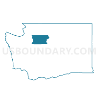
Maps

Graphs
Select a template below for downloading or customizing gragh for Holiday Voting District, Snohomish County, Washington


Neighbors
Neighoring Voting District (by Name) Neighboring Voting District on the Map
- Cascade Voting District, Snohomish County, WA
- Dumas Voting District, Snohomish County, WA
- Everett 52 Voting District, Snohomish County, WA
- Everett 91 Voting District, Snohomish County, WA
- Everett 92 Voting District, Snohomish County, WA
- Mill Creek 13 Voting District, Snohomish County, WA
- Mill Creek 7 Voting District, Snohomish County, WA
- Silver Lake Voting District, Snohomish County, WA
Top 10 Neighboring County Subdivision (by Population) Neighboring County Subdivision on the Map
Top 10 Neighboring Place (by Population) Neighboring Place on the Map
Top 10 Neighboring Unified School District (by Population) Neighboring Unified School District on the Map
Top 10 Neighboring State Legislative District Lower Chamber (by Population) Neighboring State Legislative District Lower Chamber on the Map
- State House District 44, WA (156,499)
- State House District 21, WA (133,156)
- State House District 38, WA (129,624)
Top 10 Neighboring State Legislative District Upper Chamber (by Population) Neighboring State Legislative District Upper Chamber on the Map
- State Senate District 44, WA (156,499)
- State Senate District 21, WA (133,156)
- State Senate District 38, WA (129,624)